Reading a map and compass is an essential skill for navigation in the wilderness. Understanding the elements of a map and compass is crucial for accurately determining your location, planning routes, and staying on course. Below, I’ll describe the key elements of both a map and a compass and provide an overview of how to use them for navigation.
Reading a Map:
- Scale: The scale of a map indicates the relationship between distances on the map and distances on the ground. It’s usually expressed as a ratio, such as 1:25,000, where one unit on the map represents 25,000 of the same units on the ground.
- Legend: The legend, or map key, explains the symbols, colors, and icons used on the map. It helps you interpret the features and landmarks depicted.
- Grid Lines: Many maps have grid lines, such as latitude and longitude lines or the Universal Transverse Mercator (UTM) grid, to help you pinpoint locations with precision.
- Contour Lines: Contour lines represent elevation changes on the terrain. Lines that are close together indicate steep terrain, while lines that are farther apart represent flatter areas.
- North Arrow or Compass Rose: This element shows the orientation of the map, typically pointing to true north. It helps you align the map with your surroundings.
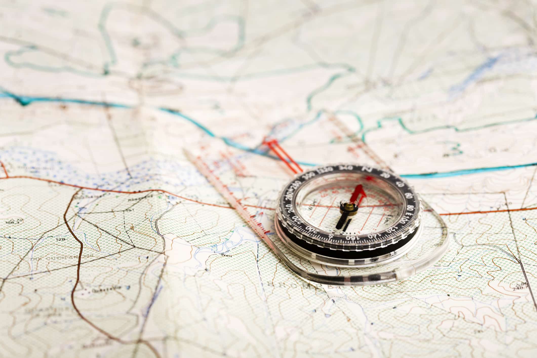
Using a Compass:
- Magnetic Needle: The magnetic needle on a compass points to the magnetic north. To use it, align the needle with the orienting arrow on the compass housing. This step ensures that your compass is oriented correctly with the Earth’s magnetic field.
- Orienting Arrow: This arrow on the compass housing helps you align the compass with your map. You match the orienting arrow with the map’s north, making it easier to follow your intended route.
- Baseplate and Ruler: The baseplate often has a ruler or a scale that you can use to measure distances on the map.
- Rotating Bezel: The rotating bezel allows you to set your desired bearing. To navigate, turn the bezel until the orienting lines on the baseplate align with the compass needle. The degree markings on the bezel represent your bearing.
How to Read a Map and Compass for Navigation:
- Begin by orienting your map. Place the compass on the map with the edge of the baseplate along your desired route. Make sure the compass arrow points to the top of the map.
- Rotate the map and compass together until the magnetic needle aligns with the orienting arrow.
- Now, your map is oriented correctly, and you can read your bearing from the bezel.
- To navigate, hold the compass level and point it in the direction of your bearing, making sure the north end of the magnetic needle still aligns with the orienting arrow.
- Follow this direction to reach your destination, using landmarks and features on the map to stay on track.
By understanding how to read a map and compass, you can navigate effectively in the wilderness, plan routes, and ensure you stay on the right path, even in unfamiliar terrain.
Leave a Reply
You must be logged in to post a comment.